Have you ever wondered where birds go when the seasons change? Bird migration maps can unlock the mystery behind these incredible journeys.
These maps show you the exact paths birds take across continents, helping you understand their travel patterns like never before. Whether you’re a bird lover, a curious traveler, or just someone fascinated by nature, these maps will surprise and inspire you.
Keep reading to discover how bird migration maps can change the way you see the skies above.
Bird Migration Basics
Bird migration is a regular journey birds take between breeding and wintering areas. It helps them find food and better living conditions.
Many species travel thousands of miles during migration. Understanding why and how they move is important for bird watchers and scientists.
Why Birds Migrate
Birds migrate to survive. They leave places with cold weather or less food to find warmer areas and more food.
- To find food when seasons change
- To breed in safe and suitable places
- To avoid harsh weather conditions
- To increase chances of survival for their young
Common Migration Patterns
Birds follow different routes and schedules during migration. Some travel during the day, others at night.
| Pattern | Description |
| Long-Distance | Thousands of miles, crossing continents and oceans |
| Short-Distance | Travel within a region or country |
| Altitudinal | Moving up and down mountains with seasons |
| Partial | Only some members of a species migrate |
Factors Influencing Migration
Several factors affect bird migration. These include weather, food supply, and daylight length.
Key factors that influence migration:
- Temperature changes that signal season shifts
- Availability of food sources along the route
- Length of daylight affecting bird behavior
- Wind patterns that can help or slow down travel
- Genetic instincts passed down through generations
Types Of Migration Maps
Bird migration maps show the paths birds take when they move from one place to another. These maps help scientists and bird watchers understand where birds travel during different seasons.
There are different types of migration maps. Each type uses unique tools and methods to track bird movements.
Traditional Paper Maps
Traditional paper maps are the oldest form of migration maps. They are drawn by hand or printed with bird routes marked on them.
Bird watchers and scientists use these maps to record sightings and plan studies. These maps are easy to carry but cannot show real-time changes.
Digital And Interactive Maps
Digital maps show bird migration routes on computers or mobile devices. They often include features like zooming and clicking for more details.
Interactive maps allow users to explore bird paths and see updates quickly. They use data from many bird watchers and automated systems.
- Zoom in to see specific regions
- Click on routes for bird species info
- View migration timing and patterns
Satellite Tracking Maps
Satellite tracking maps use GPS devices attached to birds. These devices send location data to satellites in real time.
Scientists get precise information about bird routes, speed, and stopovers. These maps show very accurate and current migration paths.
How Migration Maps Are Created
Migration maps show where birds travel during their seasonal journeys. Scientists use many methods to track and record bird movements. These maps help us understand bird behavior and protect their habitats.
Creating accurate migration maps requires collecting data from different sources. Each method adds valuable information to the overall picture of bird migration routes.
Data Collection Methods
Scientists gather bird migration data through several ways. These include observing birds in the wild, using technology, and studying marked birds. Each method has strengths and limitations.
- Visual observations during migration seasons
- Tracking devices attached to birds
- Radar systems that detect flocks in flight
- Analysis of bird banding records
Role Of Bird Banding
Bird banding involves placing a small ring on a bird’s leg. This ring has a unique code that identifies the bird. When the bird is seen or caught again, its location is recorded.
| Purpose | Details |
| Track individual birds | Identify migration paths of specific birds |
| Study bird lifespan | Monitor survival rates over years |
| Gather data on bird behavior | Learn about stopover sites and timing |
Use Of Gps and Radar Technology
GPS trackers attach to birds and send location data via satellites. Radar technology detects large groups of birds flying at night or in bad weather. Together, they provide detailed migration information.
Key benefits of GPS and radar technology:
- Accurate, real-time tracking data
- Ability to monitor remote or hard-to-see areas
- Data collection regardless of weather conditions
- Detection of flight altitude and speed

Credit: www.ebay.ca
Top Tools For Tracking Migration
Bird migration maps help us see where birds travel during the year. These maps show the paths birds take from one place to another.
There are many tools to track migration. They include apps, websites, and community platforms. These tools provide real-time data and maps.
Popular Bird Migration Apps
Many apps help bird watchers follow migration patterns. These apps offer live maps and bird sightings.
Users can see routes, timing, and bird types. Some apps also let users share their own observations.
- BirdsEye Bird Finding Guide
- eBird Mobile
- iBird Pro Guide to Birds
- Merlin Bird ID
Websites And Online Resources
Websites offer detailed migration maps and reports. They gather data from many sources to provide accurate tracking.
These sites often include educational resources for bird watchers and students.
- eBird.org – Tracks bird sightings worldwide
- BirdCast – Provides migration forecasts and maps
- Audubon – Offers migration maps and bird info
- All About Birds – Guides and tracking tools
Community Science Platforms
Community science platforms collect data from many bird watchers. This data helps improve migration maps.
People can upload bird sightings and photos. This shared data supports research and conservation efforts.
- eBird – Global bird sighting database
- iNaturalist – Nature observations including birds
- Project FeederWatch – Tracks birds at feeders
- Christmas Bird Count – Annual bird census
Interpreting Migration Maps
Bird migration maps show the paths birds take during their seasonal travels. They help us understand where birds go and how they move.
Reading these maps is important for bird watchers, scientists, and nature lovers. It reveals important details about bird behavior.
Reading Movement Patterns
Movement patterns on migration maps show the routes birds follow. Lines or arrows usually mark these paths.
Maps may use colors or symbols to show different bird species or groups. You can see how far and fast birds travel.
- Solid lines show common migration routes
- Dashed lines may indicate less-used paths
- Arrows point in the direction of travel
- Colors often represent different species or times
Identifying Stopover Sites
Stopover sites are places where birds rest and eat during migration. These spots are critical for their survival.
On migration maps, stopover sites often appear as dots or shaded areas. They show where birds pause before continuing.
- Look for clusters of points along migration routes
- Large, shaded areas often mark important stopovers
- Some maps show how long birds stay at each site
Seasonal Timing Insights
Migration maps can reveal when birds start and end their journeys. Timing is key to understanding bird migration.
Maps may use different colors or labels to show spring and fall migrations. This helps track changes in bird schedules.
- Spring migration maps show northward routes
- Fall migration maps show southward routes
- Dates or months may be marked to show timing
- Changes in timing can signal environmental shifts
Benefits Of Tracking Bird Migration
Tracking bird migration helps us learn where birds travel each year. It shows their routes and stops. This data is useful for many reasons.
Scientists and conservationists use migration maps to protect birds and their habitats. Birdwatchers also enjoy better experiences with this knowledge.
Conservation Efforts
Knowing bird migration patterns helps protect important places. Conservation groups can focus on safe spots birds use during their journey.
- Identify key resting and feeding areas
- Protect habitats from destruction
- Plan safe migration corridors
- Reduce risks from human activities
Scientific Research
Migration data supports many scientific studies. Researchers track changes in bird behavior and health over time. This helps understand climate effects and species survival.
| Research Area | How Tracking Helps |
| Climate Change | Shows shifts in migration timing |
| Species Decline | Identifies critical habitats |
| Bird Behavior | Reveals migration speed and routes |
Enhancing Birdwatching Experiences
Birdwatchers use migration maps to find rare and seasonal birds. Maps guide them to the best viewing spots and times.
Tips for Birdwatchers Using Migration Maps:
- Check maps before planning trips
- Visit locations during peak migration
- Use maps to spot new species
Challenges In Mapping Migration
Mapping bird migration is a hard job that needs careful work. Many problems make it tough to track birds during their long trips.
Scientists use maps to understand where birds fly and how far they travel. These maps help protect birds and their homes.
Data Accuracy Issues
Data accuracy is a big problem in bird migration maps. Sometimes the data is wrong or incomplete.
Birds can move fast and far. Tracking devices may miss some parts of their journey. This leads to errors in maps.
- Tracking devices may lose signal
- Birds may fly outside monitored areas
- Manual observations can be mistaken
Technological Limitations
Technology helps track birds but also has limits. Some devices are heavy or use much power. This affects small birds.
Not all areas have good coverage for tracking signals. This makes it hard to follow birds in remote places.
- Weight of tracking devices can harm birds
- Short battery life limits tracking time
- Remote areas lack tracking network
Impact Of Climate Change
Climate change changes bird routes and timing. This makes old maps less useful over time.
Birds may fly to new places or at new times. This creates new challenges for tracking and protecting them.
- Shifts in temperature affect migration timing
- New food sources change bird paths
- Habitat loss forces birds to find new routes
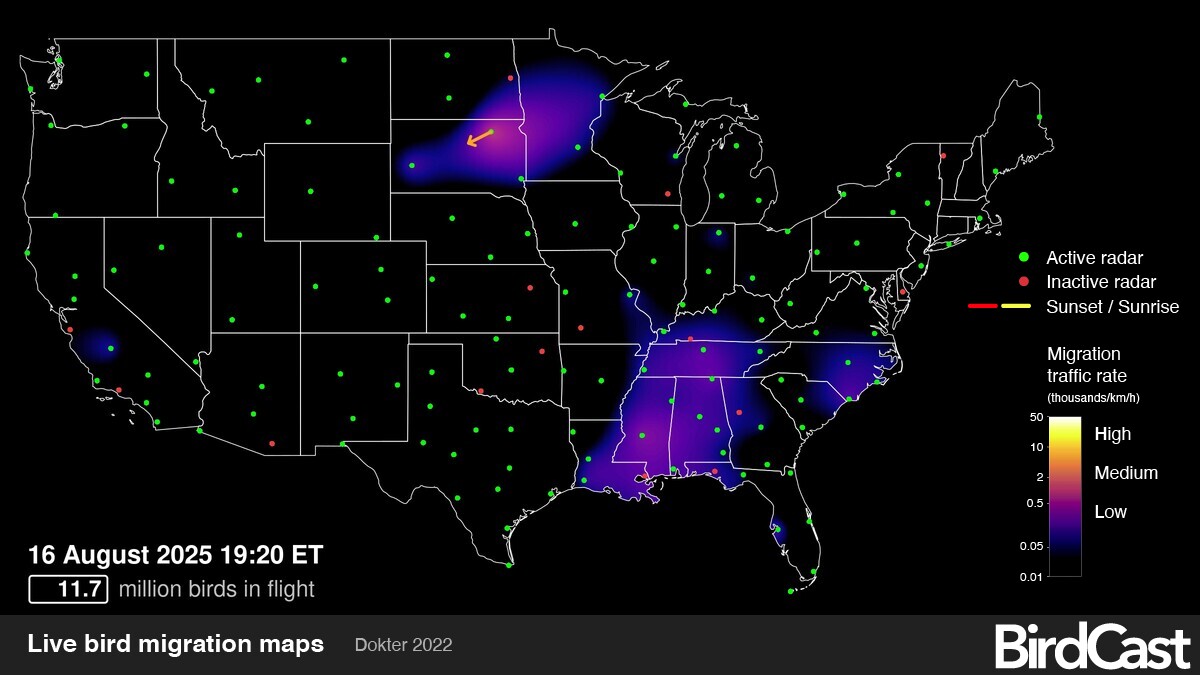
Credit: birdcast.info
Future Of Bird Migration Mapping
Bird migration maps show where birds travel each year. These maps help scientists learn about bird routes and behaviors. New technology will make these maps more detailed and accurate.
Understanding bird migration is important for protecting birds and their habitats. The future will bring better tools and teamwork to improve migration maps.
Advances In Tracking Technology
New tracking devices are smaller and lighter than before. They can follow birds for longer times without affecting them. Solar-powered tags and tiny GPS trackers give precise location data.
- Lightweight GPS tags for small birds
- Solar-powered tracking devices
- Longer battery life for continuous data
- Real-time tracking with satellite links
Integration With Ai and Big Data
Artificial intelligence (AI) can analyze large amounts of migration data quickly. It finds patterns and predicts changes in bird routes. Big data helps combine information from many sources.
| AI Use | Description |
| Pattern Recognition | Detects migration trends in data |
| Route Prediction | Forecasts future bird paths |
| Data Cleaning | Removes errors in tracking records |
| Species Identification | Classifies birds from images and sounds |
Global Collaboration Initiatives
Scientists and organizations worldwide share migration data. This teamwork improves map coverage and accuracy. Shared databases make it easier to study birds across countries.
- Access to more tracking data
- Standardized data formats
- Joint conservation efforts
- Faster response to environmental changes

Credit: www.allaboutbirds.org
Frequently Asked Questions
What Are Bird Migration Maps Used For?
Bird migration maps track birds’ seasonal routes worldwide. They help scientists study migration patterns and protect habitats. Bird watchers use them to find bird locations. These maps reveal how birds adapt to environmental changes. They are valuable for conservation and education.
How Do Bird Migration Maps Work?
Bird migration maps use data from GPS trackers and bird banding. They show routes, stopover sites, and timing of migration. Maps are updated with real-time tracking for accuracy. This technology helps understand bird behavior and migration challenges.
Where Can I Find Reliable Bird Migration Maps?
Reliable bird migration maps are available on websites like Audubon and Cornell Lab. Government wildlife agencies and birding apps also provide accurate maps. These sources offer updated, interactive maps for easy viewing and study.
Why Is Bird Migration Important to Track?
Tracking bird migration helps protect species and ecosystems. It reveals environmental changes and threats to birds. Migration data supports conservation efforts and informs policies. Understanding migration ensures birds’ survival amid climate change.
Conclusion
Bird migration maps offer fascinating insights into nature’s wonders. They help us understand bird routes and habitats. These maps are vital for bird conservation efforts. They also enhance our appreciation for these incredible journeys. Tracking migration patterns aids in protecting bird species.
It ensures their survival for future generations. Observing birds’ travel paths connects us to nature. It reminds us of our role in preserving wildlife. As we learn more, we support a healthier ecosystem. Let’s continue to explore and protect our feathered friends.
Their journeys inspire us all.